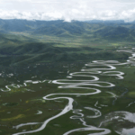
Imagine monitoring one of Earth’s most remote ecosystems—Sanjiangyuan, the source of Asia’s Yellow, Yangtze, and Lancang rivers—from a high-tech control room 🖥️. That’s exactly what’s happening in Xining, where the Sanjiangyuan National Big Data Center uses satellites, BeiDou GPS, and ground sensors to track real-time changes in this 4,500-meter-high ‘Water Tower.’
👀 Eyes on Every Drop
A giant dashboard displays melting snow, greening wetlands, and even wandering wildlife like wild yaks 🐂. Water levels, vegetation health, and snow cover? All tracked instantly. If something’s off, alerts go out—no need for daily treks across the harsh Tibetan Plateau.
🚀 Tech Over Boots
‘This isn’t just data—it’s a lifeline,’ says CGTN’s Yang Xinmeng. By relying on AI and remote sensing, China’s eco-guardians protect these vital rivers from over 1,000 km away. Less footprint, more impact 🌱.
Reference(s):
cgtn.com


