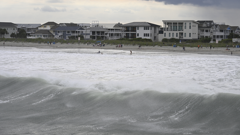
Hurricane Erin is making waves—literally—as it churns northward in the Atlantic, hundreds of miles offshore. While the storm isn’t expected to make direct landfall, its ripple effects are already causing alarm along the U.S. East Coast. Coastal areas, including North Carolina’s iconic Outer Banks, are bracing for dangerous storm surges and tropical storm conditions this week. 🌩️
Think of Erin as nature’s slow-burn thriller: though it’s staying offshore, its sheer size and power could trigger flooding, strong winds, and beach erosion. Local authorities are urging residents and travelers to stay vigilant. 🚨 'Even indirect impacts can be severe,' one official warned. 'Don’t underestimate this storm.'
For surfers and storm chasers, Erin might look like a tempting spectacle, but experts say it’s not worth the risk. Coastal roads could become impassable, and emergency services are on high alert. Meanwhile, social media is buzzing with surreal videos of choppy seas and swaying palm trees—#StormTok, anyone? 📱💨
Stay tuned for real-time updates as Erin’s path evolves. Whether you’re a local, a traveler, or just a weather geek, now’s the time to keep those weather apps open and emergency kits ready. 🌎🔍
Reference(s):
Live: Erin offshore in Atlantic, triggers storm surge in the U.S.
cgtn.com


