When Satellites Meet Smart Cities 🌆
Hold onto your hard hats! Chinese AI satellite firm STAR.VISION and Oman’s Lens LLC just dropped a tech collab that could redefine how cities are built. Their new digital twin platform – announced at Muscat’s 2024 COMEX Global Tech Show – uses space tech to create 3D city models smarter than your latest TikTok filter.
Why It’s Lit 🔥
This isn’t just about pretty maps. The system analyzes everything from tree coverage 🌳 to emergency routes 🚨 using AI and satellite imagery. Think: climate-resilient urban planning that could make 『SimCity』 look like child’s play.
Belt, Road & Bytes 🛤️💻
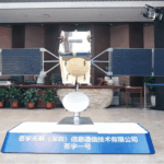
Aligned with China’s Belt and Road Initiative and Oman’s Vision 2040, this partnership follows their 2023 launch of WonderJourney-1A – Oman’s first AI satellite. STAR.VISION cofounder Noor Fan told Xinhua: 『We’re bridging the gap between orbital tech and sidewalk-level solutions.』
Urban planners, meet your new toolbox 🧰. The rest of us? Let’s watch as desert cities get a digital glow-up 💡.
Reference(s):
Chinese, Omani AI satellite companies to cooperate on urban planning
cgtn.com


