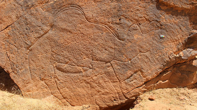
12,000-Year-Old Rock Art Unlocks Desert Survival Secrets
Imagine trekking through a scorching desert 12,000 years ago – no GPS, no water bottles. How did ancient hunter-gatherers navigate? They carved giant camel maps into cliffs! 🗺️ New research reveals life-sized rock art in Saudi Arabia’s Nefud desert region served as prehistoric Google Maps for vital water sources.
Art Meets Survival Strategy
Archaeologists discovered over 130 animal engravings – including 2.6-meter-tall camels – across 30km of mountainous terrain. These weren’t just doodles: ‘The carvings marked critical resources in one of Earth’s harshest environments,’ says lead researcher Maria Guagnin from the University of Sydney.
Dangerous Desert Canvas
Some cliffside engravings were 39 meters high! 🧗 ‘Engravers stood on narrow ledges, unable to see their full artwork while creating it,’ Guagnin explains. Talk about extreme art sessions – all while avoiding deadly falls!
More Than Just Camels
The sandstone gallery features:
- 🦌 Ibex and gazelles
- 🐴 Wild donkeys
- 🐂 Aurochs (ancient cattle ancestors)
Reference(s):
Camels carved in ancient Arabian rock art indicate vital water sources
cgtn.com


