From Earthquakes to Floods: How China Deploys Satellites, Drones, and AI
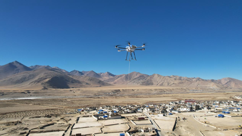
When a 7.9-magnitude earthquake rocked Myanmar in March, China activated its ‘space eyes’—14 satellites capturing high-res images to detect 480+ disaster sites ⚡. This same cutting-edge tech helped restore communications during the Xizang earthquake earlier this year using drone-based base stations 🚁. As May 12 marks China’s National Disaster Prevention Day, innovations like these are reshaping emergency responses globally 🌍.
Satellite Superpowers 🌐
China’s Fengyun meteorological satellites now beam life-saving data to 133 countries and regions. With nine in orbit, they provide ultra-precise weather tracking and disaster monitoring, helping nations from Asia to Africa predict storms, floods, and heatwaves 🔭.
Drone Fleets & Flying Firefighters 🚒
Meet the AG600—a massive amphibious aircraft recently certified for firefighting and maritime rescues. Meanwhile, the Wing Loong-2H drone became a hero in Xizang, mapping quake damage in real-time with radar and sensors 📡. In Zhejiang’s ‘Emergency Mission 2024’ drills, drones rebuilt communication networks in flood-hit areas like tech-powered lifelines 💪.
AI Speaks the Language of Rescue 🗣️
China’s homegrown AI models are breaking language barriers. During the Myanmar crisis, the DeepSeek LLM powered a trilingual translation system, helping rescuers communicate across Chinese, Burmese, and English 🆘. Guangdong even launched an AI weather assistant for the 15th National Games, crunching data faster than a TikTok trend 🎮.
From space to your smartphone, China’s blending hardware and software to turn disasters into manageable challenges—one algorithm and drone at a time ✨.
Reference(s):
cgtn.com


